In early-to-mid December 2025, Western Washington experienced one of its most consequential flood episodes in years—driven by a sequence of atmospheric rivers that delivered extraordinary precipitation, rapidly elevated rivers, and triggered levee failures, landslides, and widespread evacuations. NASA Science+2AP News+2
What an “atmospheric river” meant this time
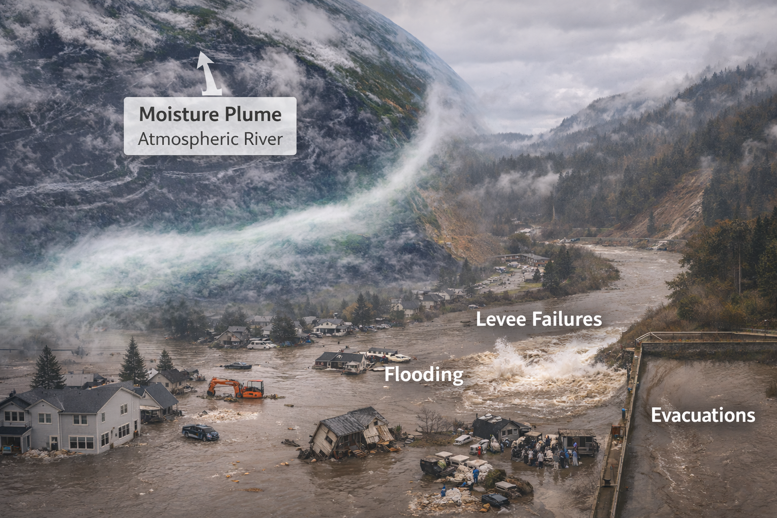
Atmospheric rivers are long, narrow corridors of concentrated water vapor that can transport immense moisture from the Pacific into the West Coast. In this event, multiple waves of Pacific moisture targeted the region over several days, producing prolonged, intense rainfall and compounding impacts as soils saturated and rivers had little capacity to absorb additional runoff. NASA’s Earth Observatory documented the moisture plume and noted that the heaviest impacts began around December 7, 2025, with flooding and landslides following as rainfall persisted. NASA Science
Record water volumes in a short window
One of the most useful ways to understand the scale is to translate rainfall into volume. KUOW analyzed rainfall over a 10-day period in December 2025 (Dec. 9–19) across 17 watersheds east of Puget Sound—from the Nooksack basin south to the Lewis—and estimated roughly nine million acre-feet of water fell in that span (not statewide totals, but specifically across those watersheds). KUOW
That magnitude helps explain why “normal” flooding safeguards became strained: the issue wasn’t one peak day, but repeated pulses of heavy precipitation layered onto already saturated ground.
Rivers hit levels that communities plan around—and beyond
As the storms lined up, multiple rivers in Western Washington reached major flood stages, with some gauges meeting or exceeding historical crests.
-
FOX 13 Seattle reported the Snoqualmie River at Snoqualmie Falls reached 17.88 feet on Dec. 9, edging above a prior high of 17.85 feet (Oct. 22, 2020). FOX 13 Seattle
-
The Weather Channel also summarized several key crests and noted that major rivers continued rising even as rainfall briefly eased, a classic lag effect when upstream basins drain into mainstem rivers. The Weather Channel
Levees and lowlands: when water meets infrastructure limits
Flooding becomes dramatically more dangerous when river systems overtop or breach flood control structures. On December 15, flash flood warnings and “go now” evacuation orders followed a breach along the Green River’s Desimone Levee area, affecting parts of Tukwila, Kent, and Renton (with shelters opening in the area). Reuters+1
Reuters reported the breach washed away a car-sized section and prompted emergency sandbagging operations. Reuters
Why this flood was so disruptive
Flood disasters are rarely one single hazard. This event stacked multiple risk layers at once:
-
Hydrology risk: rapid rises on rivers and tributaries. The Weather Channel+1
-
Geology risk: landslides and debris flows with saturated slopes and intense rain. KING 5+1
-
Infrastructure risk: levee stress, road washouts, and closures limiting evacuation routes and emergency access.
Leave a Reply